


MAPPING MANGROVE SURFACE CARBON STOCKS USING MULTISENSOR IMAGERY IN CLUNGUP MANGROVE CONSERVATION (CMC) MALANG REGENCY
Abstract
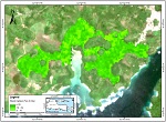
Mangroves can store carbon effectively with a value of about 1,023 Mg C/Ha and become one of the richest forests that store 4-20 billion tons of blue carbon globally. Remote sensing imagery can be used to map mangrove surface carbon stocks using radar and optical image sensors. Generally, forest carbon on earth is stored in two places, namely above the surface (Above Ground Carbon, AGC) and below the surface (Below Ground Carbon, BGC). This study aims to estimate the surface carbon stock of mangroves using multisensory imagery using the Random Forest method in the Clungup Mangrove Conservation (CMC) area, Malang Regency, East Java. Four vegetation indices (IRECI, NDI45, NDVI, SAVI), single band, and VV VH polarization were used as predictive variables. Estimating the carbon stock mangrove value using Sentinel-1 imagery produced 2,126 tons of C with R² 0.11. Meanwhile, Sentinel-2 produces an estimated carbon value of 2,025 tons C with an R² of 0.22. The estimation model using Sentinel-2 shows a better evaluation value with a Root Mean Squared Error (RMSE) of 0.89 and a Mean Absolute Error (MAE) of 0.75. The IRECI vegetation index is the most important variable in estimating carbon stocks. The results of the mapping accuracy of the Sentinel-1 model show a value of 34.73% and Sentinel-2 35.03%.
Keywords: Mangrove, Carbon, Sentinel-1, Sentinel-2, Random Forest
Full Text:
PDFReferences
Alan, J., Castillo, A., Apan, A. A., Maraseni, T. N., & Salmo, S. G. (2017). ISPRS Journal of Photogrammetry and Remote Sensing Estimation and mapping of above-ground biomass of mangrove forests and their replacement land uses in the Philippines using Sentinel imagery. ISPRS Journal of Photogrammetry and Remote Sensing, 134, 70–85. https://doi.org/10.1016/j.isprsjprs.2017.10.016
Arjasakusuma, S., Kusuma, S., Rafif, R., Saringatin, S., & Mada, U. G. (2020). Combination of Landsat 8 OLI and Sentinel-1 SAR Time-Series Data for Mapping Paddy Fields in Parts of West and Central Java Provinces, Indonesia. November. https://doi.org/10.3390/ijgi9110663
Breiman, L. (2001). Random forests. Random Forests, 1–32. https://doi.org/10.1201/9780429469275-8
Byrd, K. B., Connell, J. L. O., Di, S., & Kelly, M. (2014). Remote Sensing of Environment Evaluation of sensor types and environmental controls on mapping biomass of coastal marsh emergent vegetation. Remote Sensing of Environment, 149, 166–180. https://doi.org/10.1016/j.rse.2014.04.003
Dat Pham, T., Xia, J., Thang Ha, N., Tien Bui, D., Nhu Le, N., & Tekeuchi, W. (2019). A review of remote sensing approaches for monitoring blue carbon ecosystems: Mangroves, sea grasses and salt marshes during 2010–2018. Sensors (Switzerland), 19(8). https://doi.org/10.3390/s19081933
Donato, D. C., Kauffman, J. B., Murdiyarso, D., Kurnianto, S., & Stidham, M. (2011). Mangroves among the most carbon-rich forests in the tropics. Nature Geoscience, 4(4), 1–5. https://doi.org/10.1038/ngeo1123
Danoedoro. P. (1996). Pengolahan Citra Digital Teori dan Aplikasinya alam Bidang Penginderaan Jauh. Fakultas Geografi Universitas Gadjah Mada.
Filipponi, F. (2019). Sentinel-1 GRD Preprocessing Workflow. Proceedings, 18(1), 11. https://doi.org/10.3390/ecrs-3-06201
Frampton, W. J., Dash, J., Watmough, G., & Milton, E. J. (2013). ISPRS Journal of Photogrammetry and Remote Sensing Evaluating the capabilities of Sentinel-2 for quantitative estimation of biophysical variables in vegetation. ISPRS Journal of Photogrammetry and Remote Sensing, 82, 83–92. https://doi.org/10.1016/j.isprsjprs.2013.04.007
Ghosh, S. M., & Behera, M. D. (2018). Aboveground biomass estimation using multi-sensor data synergy and machine learning algorithms in a dense tropical forest. Applied Geography, 96(March), 29–40. https://doi.org/10.1016/j.apgeog.2018.05.011
Giri Ananto, W. H., Hadi, H. A., Sandhini Putri, A. F., Hanum, D. N., Puji Wiryawan, B. K., Prabaswara, R. R., & Arjasakusuma, S. (2019). Assessment of dual polarization in Sentinel-1 data for estimating forest aboveground biomass: case study of Barru Regency, South Sulawesi. 1137214(December 2019), 47. https://doi.org/10.1117/12.2540845
Heumann, B. W. (2011). Satellite remote sensing of mangrove forests: Recent advances and future opportunities. Progress in Physical Geography, 35(1), 87–108. https://doi.org/10.1177/0309133310385371
Kamal, M., Phinn, S., Johansen, K., & Adi, N. S. (2016). Estimation of mangrove leaf area index from ALOS AVNIR-2 data (A comparison of tropical and sub-tropical mangroves). AIP Conference Proceedings, 1755(July). https://doi.org/10.1063/1.4958480
Komiyama, A., Poungparn, S., & Kato, S. (2005). Common allometric equations for estimating the tree weight of mangroves. Journal of Tropical Ecology, 21(4), 471–477. https://doi.org/10.1017/S0266467405002476
Laurin, G. V., Balling, J., Corona, P., Mattioli, W., Papale, D., Puletti, N., Rizzo, M., Truckenbrodt, J., & Urban, M. (2018). Above-ground biomass prediction by Sentinel-1 multitemporal data in central Italy with integration of ALOS2 and Sentinel-2 data. Journal of Applied Remote Sensing, 12(01), 1. https://doi.org/10.1117/1.jrs.12.016008
Lu, D., Chen, Q., Wang, G., Liu, L., Li, G., & Moran, E. (2016). A survey of remote sensing-based aboveground biomass estimation methods in forest ecosystems. International Journal of Digital Earth, 9(1), 63–105. https://doi.org/10.1080/17538947.2014.990526
Mahyatar, P. Pemetaan Cadangan Karbon Atas Permukaan Di kawasan Mangrove Clungup, Kabupaten Malang Menggunakan Citra Wolrdview 2. Skripsi. Fakultas Geografi Universitas Gadjah Mada.
Mutanga, O., Adam, E., & Azong, M. (2012). International Journal of Applied Earth Observation and Geoinformation High density biomass estimation for wetland vegetation using WorldView-2 imagery and random forest regression algorithm. International Journal of Applied Earth Observations and Geoinformation, 18, 399–406. https://doi.org/10.1016/j.jag.2012.03.012
Nuthammachot, N., Askar, A., & Stratoulias, D. (2020). Combined use of Sentinel-1 and Sentinel-2 data for improving above-ground biomass estimation. Geocarto International, 0(0), 1–11. https://doi.org/10.1080/10106049.2020.1726507
Of, S., Backscatter, M. S. A. R., Changes, T. O., Forest, O. F., & Biomass, A. (2013). Sensitivity of multi-source sar backscatter to changes of forest aboveground biomass. 2457–2460.
Omar, H., Misman, M. A., & Kassim, A. R. (2017). Synergetic of PALSAR-2 and sentinel-1A SAR polarimetry for retrieving aboveground biomass in dipterocarp forest of Malaysia. Applied Sciences (Switzerland), 7(7). https://doi.org/10.3390/app7070675
Pflug, B., Makarau, A., & Richter, R. (2016). Processing Sentinel-2 data with ATCOR. EGU General Assembly, 66(April), 2–3. https://doi.org/10.5194/isprsarchives-XL-7-W3-677-2015.(3)
Pham, T. D., Le, N. N., Ha, N. T., Nguyen, L. V., & Xia, J. (2020). Estimating Mangrove Above-Ground Biomass Using Extreme Gradient Boosting Decision Trees Algorithm with Fused Sentinel-2 and ALOS-2 PALSAR-2 Data in. Remote Sensing. doi:10.3390/rs12050777
Pham, T. D., Yoshino, K., Le, N. N., & Bui, D. T. (2018). Estimating aboveground biomass of a mangrove plantation on the Northern coast of Vietnam using machine learning techniques with an integration of ALOS-2 PALSAR-2 and Sentinel-2A data. International Journal of Remote Sensing, 39(22), 7761–7788. https://doi.org/10.1080/01431161.2018.1471544
Su, Y., Guo, Q., Xue, B., Hu, T., Alvarez, O., Tao, S., & Fang, J. (2016). Spatial distribution of forest aboveground biomass in China: Estimation through combination of spaceborne lidar, optical imagery, and forest inventory data. Remote Sensing of Environment, 173, 187–199. https://doi.org/10.1016/j.rse.2015.12.002
Taylor, P., & Lu, D. (2007). International Journal of Remote The potential and challenge of remote sensing ‐ based biomass estimation. May 2013, 37–41. https://doi.org/10.1080/01431160500486732
Vafaei, S., Soosani, J., Adeli, K., Fadaei, H., Naghavi, H., Pham, T. D., & Bui, D. T. (2018). Improving accuracy estimation of Forest Aboveground Biomass based on incorporation of ALOS-2 PALSAR-2 and Sentinel-2A imagery and machine learning: A case study of the Hyrcanian forest area (Iran). Remote Sensing, 10(2). https://doi.org/10.3390/rs10020172
Yuniastuti, E., Anik Juli Dwi, A., & Dwi Wahyuni, N. (2012). Aplikasi Data Penginderaan Jauh Untuk Kajian Kondisi Eksisting EkosistemMangrove Di Wilayah Kepesisiran Kecamatan Pantai Labu, Kabupaten Deli Serdang,Sumatera Utara| 191. Jurnal Geografi, 191–199.
DOI: https://doi.org/10.24114/jg.v14i2.33575
Article Metrics
Abstract view : 450 timesPDF - 303 times
Refbacks
- There are currently no refbacks.
Accredited Journal, Based on Decree of the Minister of Research, Technology and Higher Education, Republic of Indonesia Number 36/E/KPT/2019
Copyright ©2020 Jurusan Pendidikan Geografi Fakultas Ilmu Sosial Universitas Negeri Medan dan Ikatan Geograf Indonesia (IGI)

This work is licensed under a Creative Commons Attribution-NonCommercial 4.0 International License.